Features diwima SmartMap
The advantages at a glance:• Record and manage all geo-objects (e.g.
raised hides, wild fields, feeding places, parking lots)• Filters help to keep track• Record and save the type, practice details (e.g.
line of sight) and condition of the spatial object• Data can be easily shared with everyone involved in the hunt (e.g.
hunting guests, driven hunt participants)• Screw the diwima® geomark to hunting ground facilities and keep the data up-to-date even easierThe diwima® digital overview map supports and supplements the district cockpit.
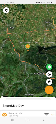
Territory-specific geodata (hide-outs, driven hunt stands, circuses, etc.) can be recorded at any time and the coordinates can be shared with fellow hunters via GoogleMaps.
The logging of the UVV inspections of the hide facilities can be documented using the checklists.
In addition, e.g.
stalking paths can be created as lines or also wild fields, wild animal quiet zones, areas damaged by wild animals etc.
as areas.
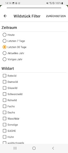
With the new filter, however, the map always remains clear.
Map themes, e.g.
a driven hunt map including drives, can also be created in the diwima® SmartMap.With the diwima® SmartMap, all area information is cartographically prepared in one place.Terms of use: https://diwima.de/bedingungen/Notes on data protection: https://diwima.de/datenschutzerklaerung/diwima.deDigitOne GmbH & Co.
KGLudgeriplatz 248151 Munster
Social Features
Connect and share with friends and the community.
Food & Dining
Discover recipes and order food from your favorite restaurants.
News & Updates
Stay informed with the latest news and updates.
See the diwima SmartMap in Action
Get the App Today
Available for Android 8.0 and above